Looking for your next cycle adventure? In Walk Wheel Cycle Trust shop, you’ll find everything you need to plan and navigate your next cycle touring adventure. Simply purchase a long distance map and the GPX file will be sent to your email address, ready for you to upload to your GPS device. To get you started, we’ve picked three of our favourite cycle routes across Wales, Scotland and England to inspire your next adventure.
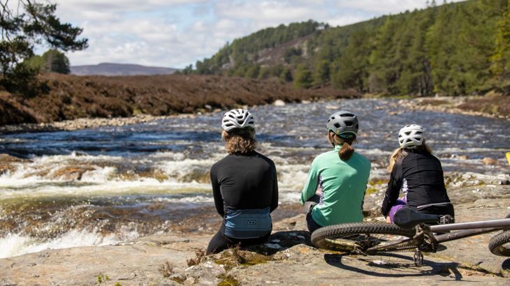
The Lochs and Glens Way takes you through stunning mountain landscape Credit: Andy Mccandlish.
Use our long distance cycle maps and GPX files to uncover scenic routes, hidden corners and traffic‑free cycle paths across the UK.
Trusted by everyday riders and seasoned tourers alike, our collection brings together the best mapping and guidance available.
All routes now come with a free GPX file.
Every purchase supports our work to make it possible for everyone to walk, wheel and cycle.
The Celtic Trail, Wales
Looking for a circular cycle route in Wales? The Celtic Trail takes in some of the most diverse scenery in Wales, taking you from the eastern 'Gateway to Wales' at the Severn Bridge to the Pembrokeshire Coast in the West.
With the map and GPX file, you can plan confidently and navigate your route through panoramic views, wildlife-rich country parks and fascinating heritage sites, this route travels right into the heart of the South Wales valleys.
Following many of the very same railways, tram roads and towpaths that once transported the raw materials of the industrial revolution, this cycle route includes a fantastic mixture of traffic-free cycle sections and quiet roads on National Cycle Network Route 4 and 47.

The Lochs and Glens Way, Scotland
Ready to explore one of Scotland's best routes? The Lochs and Glens Way offers big scenery, adventures and one unforgettable journey.
Starting off in Carlisle in Cumbria to Glasgow in Scotland, the route serves up the best of Scotland's wild side.
This map and GPX file will take you along the beautiful Solway Coast, over the hills of the Galloway Forest and to past the golden beaches of Ayrshire, before heading into buzzing Glasgow.
The route will then take you northbound — from Glasgow to Inverness — where you will cycle through two fantastic National Parks, over the historic Glen Ogle Railway Viaduct and past lochs and forests.
And to make your ride even more enjoyable, our full-colour cycle map shows the routes on traffic-free paths, quiet lanes and roads, with easy-to-read contours and route profiles.
It also features detailed inset maps for the major towns and cities and detailed day ride descriptions.
-

Carlise to Glasgow - Lochs and glens south map
Buy the map and GPX fileOne of the most scenic Scottish cycle touring routes. Plan your ride with Walk Wheel Cycle Trust's Lochs and Glens Way south cycle map and GPX file for the 215-mile (346km) ride from Carlisle to Glasgow along Route 7.
-

Glasgow to Inverness - Lochs and glens north map
Buy the map and GPX fileTake a look at one of the most scenic cycle touring routes in the UK. Plan your ride with Walk Wheel Cycle Trust's Lochs and Glens Way north cycle map and GPX file, the official cycle route for the 215-mile (346km) ride from the River Clyde in Glasgow to Inverness.

The Great Western Way travels past a number of famous landmarks following Brunel’s historic railway alongside canals, rivers and through vales. Credit: Anthea Truby.
Great Western Way, England
Follow one of England’s most iconic cross-country journeys with the Great Western Way — a relaxed yet richly rewarding ride linking Bristol and London.
Spanning around 167 miles, this largely flat route traces Brunel’s historic railway, weaving through canals, rivers and rolling countryside for an easy-going, scenic adventure.
Along the way you’ll pass engineering marvels like the Clifton suspension bridge and Caen hill locks, glide along the tranquil Kennet & Avon Canal, and roll through charming villages and vibrant towns all the way to the capital.
Our detailed cycle map and GPX file makes planning effortless, guiding you along the best paths, quiet lanes and hidden highlights — so you can focus on the ride, not the route.


Walk Wheel Cycle Trust Ortlieb bike panniers
What cycle touring set up are you using? We recommend pairing your cycle map and GPX file with a set of Ortlieb panniers. Get ready to turn any route into a fully loaded adventure — whatever the weather.
Durable, waterproof and built for distance, they’ll keep your gear safe so you can focus on the ride ahead.


