We're improving accessibility on a traffic-free section of National Cycle Network Route 7 - which makes up the popular Coast to Coast route (C2C).
Access to the path has been improved. Credit: Walk Wheel Cycle Trust
Closure at Hylton Bridge (Route 7)
A section of Route 7 (also known as C2C) at Hylton Bridge, between Sunderland and Washington, will be subject to closures and diversions from November 2025 until Summer 2026 to allow construction works to improve the path.
A further closure on the easternmost section of the route is now in place for approximately two weeks from 1 June 2026 while works are carried out to raise the level of the path to alleviate flooding. A small, direct, traffic-free diversion is in place (see map) however the surface is not sealed and may not be suitable for all users.
Making it easier for people to walk, wheel and cycle
As part of the work funded by National Highways, Walk Wheel Cycle Trust and Sunderland City Council will be removing or redesigning physical barriers on the path to improve access for all users.
We're working on a section of the Network (Route 7) which forms part of the C2C or Sea to Sea challenge route.
Work began in October 2025. Construction traffic will be using Ferryboat Lane to access the site for the duration of the works. Please take care if you plan to use this route.
The project, funded by National Highways aims to encourage more people to travel sustainably by providing a smooth, wide and dry route that can be used all year round.
Along with making the path accessible to everyone including people who use wheelchairs, adapted cycles and horse riders toow.
The accessibility improvements, on the traffic-free section between Hylton Bridge and Barmston Lane, Washington, includes:
- widening the path from 1-2 metres wide to between 2.5 and 3.5 metres
- redesigning and removing physical barriers, also known as access controls
- cutting back vegetation either side of the path
- replacing the current dust and stone surface with a more solid surface (material to be confirmed)
- raising the path to prevent flooding.
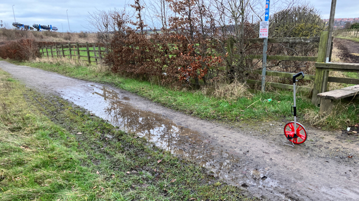
Before work started to raise the path to prevent flooding. Credit: Josh Morland

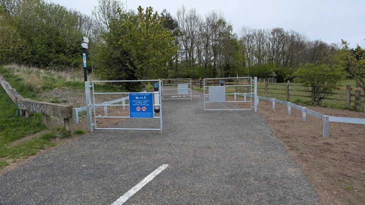
The path has been widened and resurfaced. Credit: Walk Wheel Cycle Trust
A popular path for leisure and commuting
As well as being part of the popular C2C challenge ride which is completed by an estimated 12,000 to 15,000 people per year, the path is also well used by commuters travelling to many of the large employers in the area.
The majority of the works are now complete and most of the route has now reopened however, further works will be carried out on the eastern section of the path. A short diversion will be signposted during this time (see map below).
If you have any comments, queries or concerns about the project, you can get in touch with us via email.

The area in yellow is where the route is closed. The blue sections show where the route is open and the black line shows the route diversion.
-

Paths for Everyone
Take a look at our vision for the National Cycle Network and how we're working to create paths for everyone.Paths for Everyone -

Sea to Sea (C2C)
The Sea to Sea (C2C) is a 137-mile route, from Whitehaven to Sunderland.C2C or Sea to Sea


